The U.S. Space Force aims to pinpoint the true center of the Earth using lasers. Launching in 2025, the lasers will be attached to GPS satellites.
Set of Lasers
The laser retroreflector arrays (LRAs) will be installed onto two GPS III satellites, SV9 and SV10, as part of NASA’s Space Geodesy Program space sensor program. The lasers will make precise sub-centimeter-level measurements using a technique called satellite laser ranging (SLR). In a statement, Space Force officials say this allows researchers to accurately determine Earth’s center. The mission is a partnership between the Space Force, the National Geospatial-Intelligence Agency (NGA), and NASA.
“We were able to add new capabilities to the GPS constellation years ahead of schedule while ensuring the billions of people who rely on our signals daily would be unaffected,” U.S. Space Force Col. Andrew Menschner said in a statement. “We expect LRAs to be standard on future GPS vehicles and are pleased that SV9 and SV10 will have the capability prior to launch.”
Pinpointing the Center
Laser ranging relies on small bursts of laser light to detect how far objects are from one another. Pulses of light from a ground station are directed toward an object orbiting in space-equipped LRAs. The light is then reflected back to the original source. Therefore, scientists can calculate the distance between the satellite and the ground using the time the light bounced back and forth.
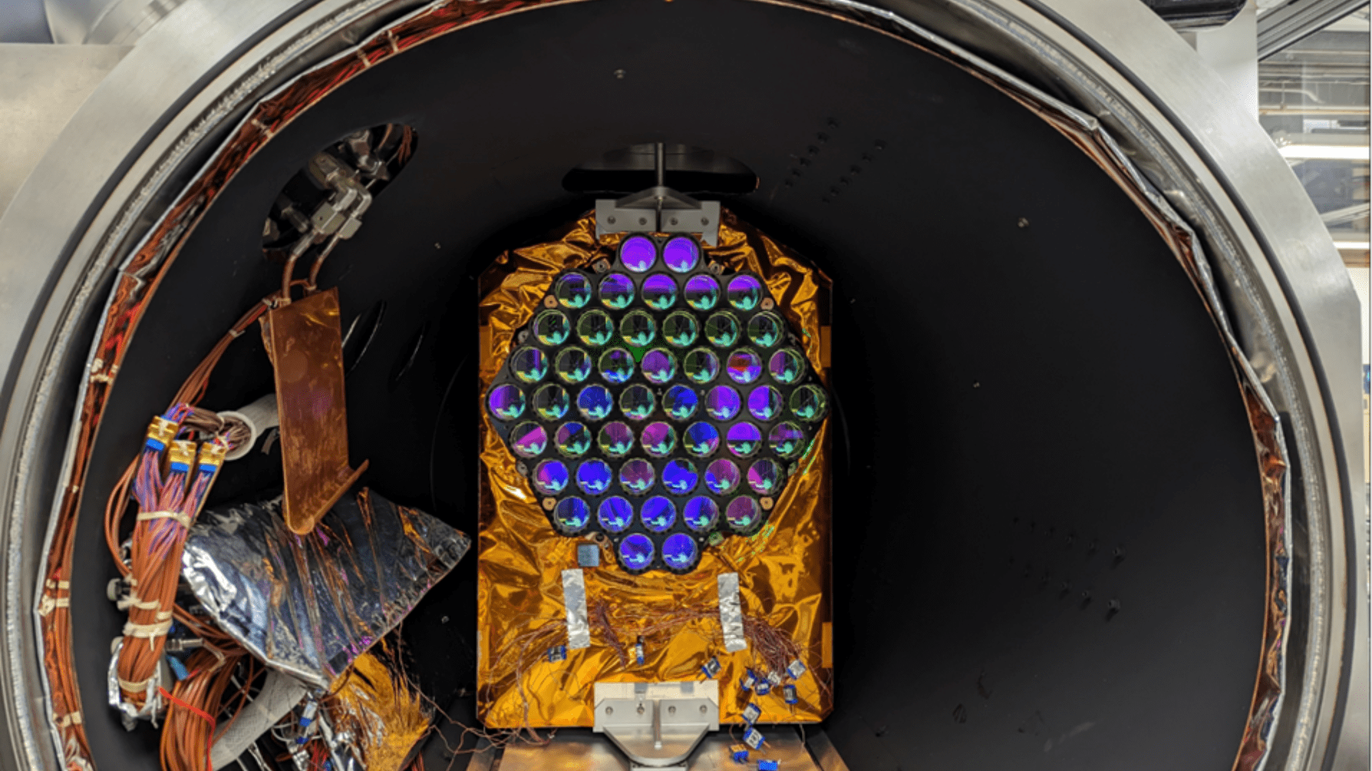
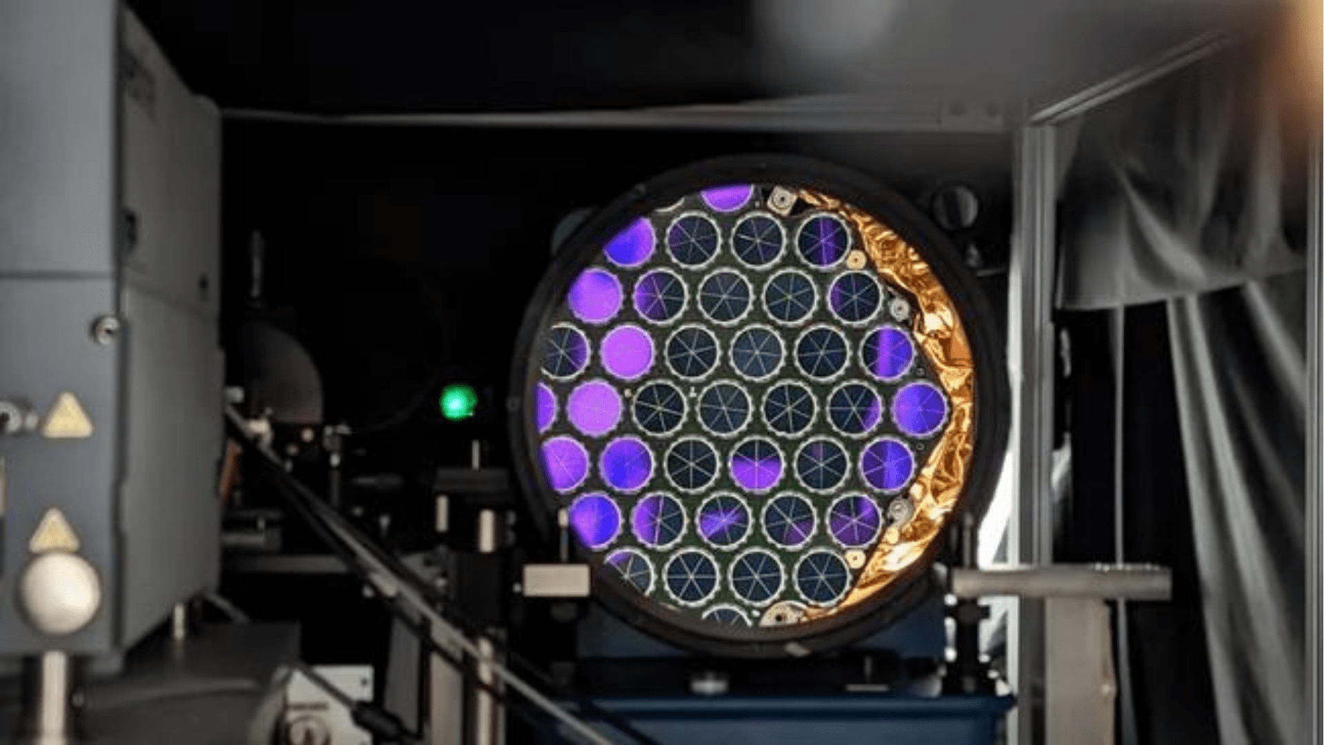
The light is reflected using three mirrors positioned at right angles, forming a cube’s corner. The LRAs consist of an array of 48 mirrored cube corner cubes that ensure the light is beamed back to the ground at the same angle. According to the statement, the LRAs were built by NASA and the Naval Research Laboratory’s Naval Center for Space Technology and will be operated by the U.S. Space Force.
The Importance
Accurately positioning information is key to finding the center of the Earth to track changes. For example, our planet undergoes small changes after tsunamis and earthquakes. Therefore, the data collected by the LRAs allows researchers to measure how the world is changing accurately.
“GPS III putting two new reflectors on orbit next year shows how quickly we are able to upgrade capabilities,” Menschner said in the statement. “This success is an incredible tribute to the outstanding talent, mission focus, and partnering across the entire team.”